Franko Maps

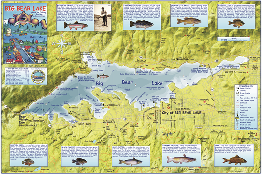
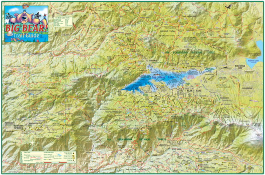
Big Bear Lake California Wall Map
This map shows Big Bear Lake in detail, with water depths and contours, docks, marinas and launches, beaches, picnic areas, surrounding streets, trails and paths. Illustrations and info on 9 common fish species found in the lake.
Page Size: 36.25 x 24 in (918 x 610 mm)
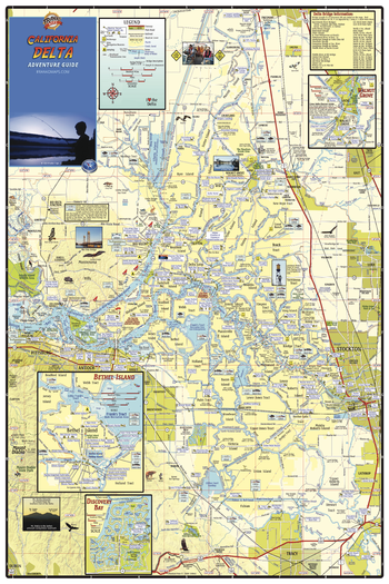
California Delta Waterways Wall Map
Detailed waterways map of the San Joaquin and Sacramento Rivers. Shows the area from Sacramento on the north to Tracy on the south, and from Stockton on the east to Pittsburg on the west. Insets of Walnut Grove, Bethel Island and Discovery Bay.
Page Size: 24 x 36 in (610 x 914 mm)
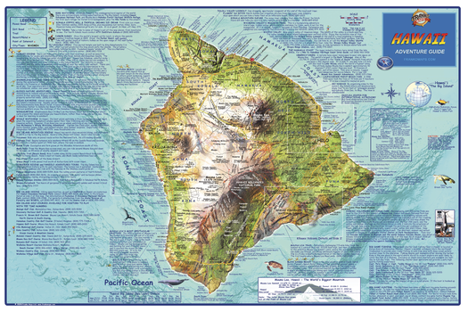
Hawaii "Big Island" Wall Map
This map shows the island of Hawaii on a detailed dramatic relief map. Hypsometric tinting employs colors to visualize land heights and water depths. Descriptions of outdoor recreation opportunities, golf courses, points of interest and more.
Page Size: 36 x 24 in (914 x 610 mm)
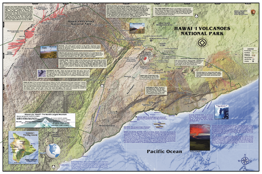
Hawaii Volcanoes National Park Wall Map
Discover the wild beauty of creation with the most up to date map of this fascinating park, a UNESCO World Heritage Site. Filled with map details and text for park visitors, including roads, campsites, the history of lava flows from Kilauea and Mauna Loa.
Page Size: 36 x 24 in (914 x 610 mm)
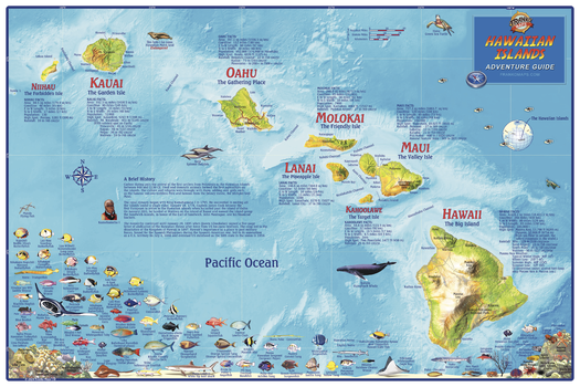
Hawaiian Islands Wall Map
A colorful map of the entire island chain with shaded relief. Hypsometric tinting employs color to denote land heights and water depths. Dozens of Hawaii's exotic fish and reef creatures are beautifully illustrated. Facts and statistics for each island.
Page Size: 36 x 24 in (914 x 610 mm)
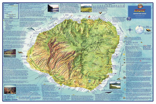
Kauai, Hawaii Wall Map
The entire island of Kauai depicted on a detailed, dramatic relief map. Hypsometric tinting employs colors to visualize land heights and water depths. Descriptions of outdoor recreation opportunities, golf courses, points of interest and more.
Page Size: 36 x 24 in (914 x 610 mm)
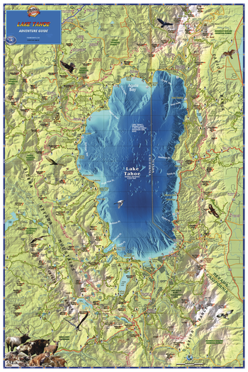
Lake Tahoe, California Wall Map
A gorgeous, detailed map of the lake and surrounding area, with land and water shading, extending at least 6 miles beyond the lake in each direction. The map shows town and place names, roads, the Tahoe Rim Trail and other hiking trails, national forests and recreation areas, ski areas, golf courses, mountain peaks, anchorages, and more.
Page Size: 24 x 36 in (610 x 914 mm)
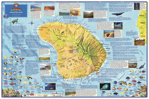
Lanai, Hawaii Wall Map
The entire island of Lanai depicted on a detailed, dramatic relief map. Hypsometric tinting employs colors to visualize land heights and water depths. Descriptions of outdoor recreation opportunities, golf courses, points of interest and more.
Page Size: 36 x 24 in (914 x 610 mm)
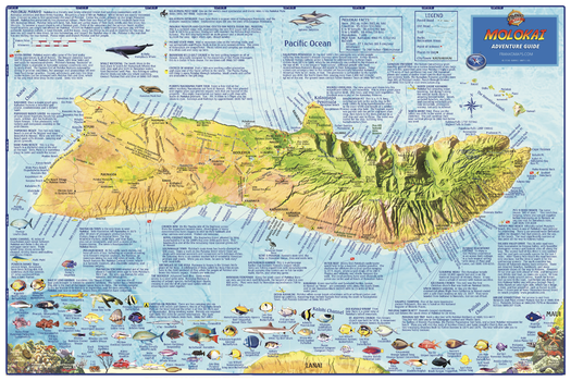
Molokai, Hawaii Wall Map
The entire island of Molokai depicted on a detailed, dramatic relief map. Hypsometric tinting employs colors to visualize land heights and water depths. Descriptions of outdoor recreation opportunities, points of interest and more. Dive and snorkel sites are named and described. There are colorful illustrations of beautiful fish and coral reef creatures.
Page Size: 36 x 24 in (914 x 610 mm)
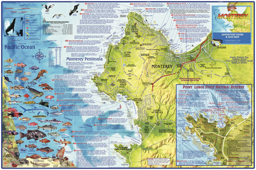
Monterey Bay, California Wall Map
This relief map depicts the Monterey Peninsula and environs, including Sand City, Pacific Grove, Pebble Beach, Carmel and Point Lobos. Dive and snorkel sites are located, named and described. The map has surfing and kayaking spots, roads and bike routes and points of interest. There is a detailed inset of Point Lobos State Natural Reserve. Also, colorful illustrations of fish and other kelp forest creatures.
Page Size: 36 x 24 in (914 x 610 mm)
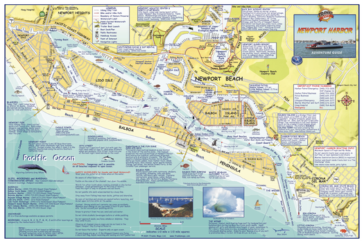
Newport Harbor, California Wall Map
A detailed map of this aquatic playground, includes Newport Beach and the Balboa Peninsula. Locates and and describe places to surf, body board, kayak, dive, snorkel, and bird watch. Includes paved bike/hike trails, hiking only trails, trailer boat launches, boat docks/piers, public restrooms, handicap access, things to do and places to go.
Page Size: 36 x 24 in (914 x 610 mm)
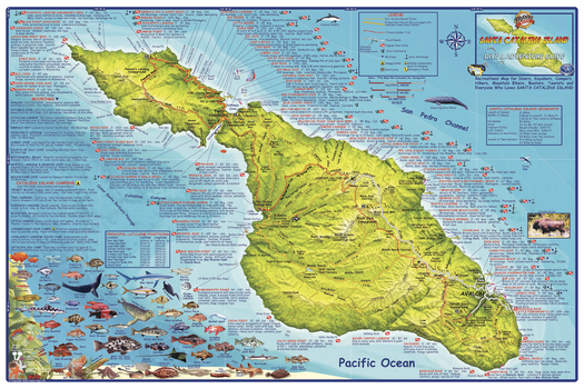
Santa Catalina Island, California Wall Map
A shaded relief topographic map of this recreational destination. Shows dirt roads, dive sites, snorkel sites, moorings, campground, anchorages, the Trans-Catalina Trail and more. Locations, names and descriptions of diving and snorkeling sites. Colorful illustrations of fish and other creatures found in the Catalina waters.
Page Size: 36 x 24 in (914 x 610 mm)
