XYZ Maps

Aberdeen - AB - Postcode Wall Map
The Aberdeen Postcode Sector Wall Map clearly shows detailed postcode sector boundaries (AB1 1, AB1 2) on a comprehensive background and is perfect for determining postcode boundaries for sales areas, planning mailshots and also an excellent reference for logistics. This wall map covers the whole of the AB Postcode Area.
Page Size: 47 x 33.25 in (1189 x 841 mm)
Angus & Aberdeenshire Postcode Sector Wall Map (S20)
The Angus & Aberdeenshire Postcode Sector Wall Map shows detailed postcode sector boundaries along with its associated label (AB1 1, AB1 2) on a comprehensive background and is perfect for determining postcode boundaries, for sales, logistics, planning mailshots or as a regional reference guide.
Page Size: 33.25 x 47 in (841 x 1189 mm)
Bath - BA - Postcode Wall Map
The Bath Postcode Sector Wall Map shows detailed postcode sector boundaries (BA1 1, BA1 2) on a comprehensive background and is perfect for determining postcode boundaries for sales areas, planning mailshots and also an excellent reference for logistics. This wall map covers the whole of the BA Postcode Area.
Page Size: 47 x 33.25 in (1189 x 841 mm)
Bedfordshire County Map
This is a large ceremonial county map of Bedfordshire highlighting the county border, with the surrounding area faded out for excellent contrast. The map covers Ampthill, Luton, Biggleswade, Dunstable, Leighton Buzzard and Sandy. The county map shows the latest County and Unitary Authority Boundaries, overlaid on a clear and easy to read Ordnance Survey map.
Page Size: 33.25 x 47 in (841 x 1189 mm)
Belfast - BT - Postcode Wall Map
The Belfast Postcode Sector Wall Map shows detailed postcode sector boundaries (BT1 1, BT1 2) on a comprehensive background and is perfect for determining postcode boundaries for sales areas, planning mailshots and also an excellent reference for logistics. This wall map covers the whole of the BT Postcode Area.
Page Size: 47 x 33.25 in (1189 x 841 mm)
Berkshire County Map
This is a large ceremonial county map of Berkshire highlighting the county border, with the surrounding area faded out for excellent contrast. The map covers Abingdon, Didcot, Harwell, Hungerford, Maidenhead, Newbury, Reading, Wantage and Windsor. The county map shows the latest County and Unitary Authority Boundaries, overlaid on a clear and easy to read Ordnance Survey map.
Page Size: 47 x 33.25 in (1189 x 841 mm)
Birmingham - B - Postcode Wall Map
The Birmingham Postcode Sector Wall Map shows detailed postcode sector boundaries (B1 1, B1 2) on a comprehensive background and is perfect for determining postcode boundaries for sales areas, planning mailshots and also an excellent reference for logistics. This wall map covers the whole of the B Postcode Area.
Page Size: 33.25 x 47 in (841 x 1189 mm)
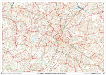
Birmingham City Centre Postcode Sectors Wall Map (C4)
The Birmingham City Centre Poscode Sector Wall Map shows detailed postcode sector boundaries along with its associated label (B1 1, B1 2) on a comprehensive background and is perfect for determining postcode boundaries, for sales, logistics, planning mailshots or as a regional reference guide.
Page Size: 47 x 33.25 in (1189 x 841 mm)
Blackburn - BB - Postcode Wall Map
The Blackburn Postcode Sector Wall Map shows detailed postcode sector boundaries (BB1 1, BB1 2) on a comprehensive background and is perfect for determining postcode boundaries for sales areas, planning mailshots and also an excellent reference for logistics. This wall map covers the whole of the BB Postcode Area.
Page Size: 47 x 33.25 in (1189 x 841 mm)
Blackpool - FY - Postcode Wall Map
The Blackpool Postcode Sector Wall Map shows detailed postcode sector boundaries (FY1 1, FY1 2) on a comprehensive background and is perfect for determining postcode boundaries for sales areas, planning mailshots and also an excellent reference for logistics. This wall map covers the whole of the FY Postcode Area.
Page Size: 33.25 x 47 in (841 x 1189 mm)
Bolton - BL - Postcode Wall Map
The Bolton Postcode Sector Wall Map shows detailed postcode sector boundaries (BL1 1, BL1 2) on a comprehensive background and is perfect for determining postcode boundaries for sales areas, planning mailshots and also an excellent reference for logistics. This wall map covers the whole of the BL Postcode Area.
Page Size: 47 x 33.25 in (1189 x 841 mm)
Bournemouth - BH - Postcode Wall Map
The Bournemouth Postcode Sector Wall Map shows detailed postcode sector boundaries (BH1 1, BH1 2) on a comprehensive background and is perfect for determining postcode boundaries for sales areas, planning mailshots and also an excellent reference for logistics. This wall map covers the whole of the BH Postcode Area.
Page Size: 47 x 33.25 in (1189 x 841 mm)
Bradford - BD - Postcode Wall Map
The Bradford Postcode Sector Wall Map shows detailed postcode sector boundaries (BD1 1, BD1 2) on a comprehensive background and is perfect for determining postcode boundaries for sales areas, planning mailshots and also an excellent reference for logistics. This wall map covers the whole of the BD Postcode Area.
Page Size: 33.25 x 47 in (841 x 1189 mm)
Brighton - BN - Postcode Wall Map
The Brighton Postcode Sector Wall Map shows detailed postcode sector boundaries (BN1 1, BN1 2) on a comprehensive background and is perfect for determining postcode boundaries for sales areas, planning mailshots and also an excellent reference for logistics. This wall map covers the whole of the BN Postcode Area.
Page Size: 47 x 33.25 in (1189 x 841 mm)
Bristol & South Gloucestershire County Map
This is a large ceremonial county map of Bristol & South Gloucestershire. highlighting the county border, with the surrounding area faded out for excellent contrast. The map covers Thornbury, Yate, Acton Turville, Kingswood Bristol, Shirehampton and Avonmouth. The county map shows the latest County and Unitary Authority Boundaries, overlaid on a clear and easy to read Ordnance Survey map.
Page Size: 33.25 x 47 in (841 x 1189 mm)
Bristol - BS - Postcode Wall Map
The Bristol Postcode Sector Wall Map shows detailed postcode sector boundaries (BS1 1, BS1 2) on a comprehensive background and is perfect for determining postcode boundaries for sales areas, planning mailshots and also an excellent reference for logistics. This wall map covers the whole of the BS Postcode Area.
Page Size: 33.25 x 47 in (841 x 1189 mm)
Bromley - BR - Postcode Wall Map
The Bromley Postcode Sector Wall Map shows detailed postcode sector boundaries (BR1 1, BR1 2) on a comprehensive background and is perfect for determining postcode boundaries for sales areas, planning mailshots and also an excellent reference for logistics. This wall map covers the whole of the BR Postcode Area.
Page Size: 47 x 33.25 in (1189 x 841 mm)
Buckinghamshire County Map
This is a large ceremonial county map of Buckinghamshire highlighting the county border, with the surrounding area faded out for excellent contrast. The map covers Aylesbury, Beaconsfiled, Buckingham, Chalfont St Giles, Eton, High Wycombe, Linslade, Marlow, Milton Keynes, Princes Risborough and Slough. The county map shows the latest County and Unitary Authority Boundaries, Overlaid on a Clear and Easy to Read Ordnance Survey map.
Page Size: 33.25 x 47 in (841 x 1189 mm)
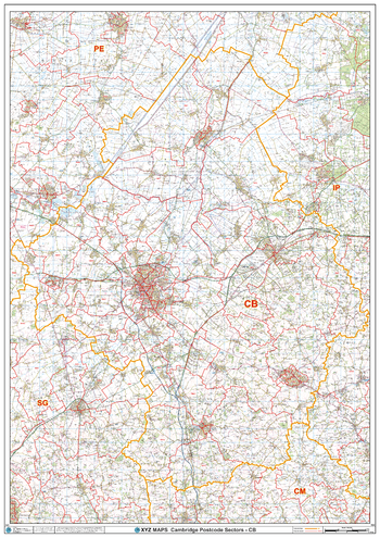
Cambridge - CB - Postcode Wall Map
The Cambridge Postcode Sector Wall Map shows detailed postcode sector boundaries (CB1 1, CB1 2) on a comprehensive background and is perfect for determining postcode boundaries for sales areas, planning mailshots and also an excellent reference for logistics. This wall map covers the whole of the CB Postcode Area.
Page Size: 33.25 x 47 in (841 x 1189 mm)
Cambridgeshire County Map
This is a large ceremonial county map of Cambridgeshire highlighting the county border, with the surrounding area faded out for excellent contrast. The map covers Burwell, Cambridge, Chatteris, Ely, Gamingley, Melbourne, Sawston, Soham, Wisbech and, Whittlesey. The county map shows the latest County and Unitary Authority Boundaries, Overlaid on a Clear and Easy to Read Ordnance Survey map.
Page Size: 33.25 x 47 in (841 x 1189 mm)


