top of page
Anchor 1

Artokoloro

empty-logo.png
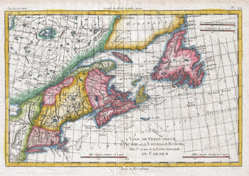
Map of New England and the Canadian Maritime Provinces (1780)

Map of New England and the Canadian Maritime Provinces (1780)

1780 map of the Canadian maritime provinces, Newfoundland, and New England by Royal Cartographer to France Rigobert Bonne (1727 - 1794), one of the most important cartographers of the late 18th century. Full title: L'Ile de Terre-Neuve, l'Acadie our la Nouvelle Ecodde, l'Ile St. Jean et la Partie Orientale du Canada

Page Size: 13.75 x 9.75 in (347 x 246 mm)

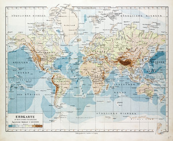
Map of the World in German (1899)

Map of the World in German (1899)

1899 map of the World in German showing sea depth and land elevations by German publisher Bibliographisches Institut in Leipzig. Full title: Erdkarte in Mercators Projekion.

Page Size: 25 x 20.5 in (635 x 515 mm)

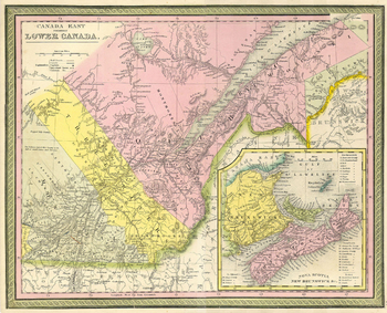
Mitchell Map of Eastern Canada including Quebec (1850)

Mitchell Map of Eastern Canada including Quebec (1850)

1850 map of eastern Canada by American geographer Samuel Augustus Mitchell. Full title: Canada East formerly Lower Canada

Page Size: 13.75 x 11.25 in (347 x 281 mm)

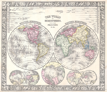
Mitchell Map of the World on Hemisphere Projection (1864)

Mitchell Map of the World on Hemisphere Projection (1864)

1864 hemisphere map of the World by America geographer Samuel Augustus Mitchell. Features the eastern and western hemispheres, with insets of the northern and southern hemispheres, the north polar region, and land and water hemispheres. Full title: The World in Hemispheres with Other Projections.

Page Size: 18 x 15.5 in (456 x 390 mm)

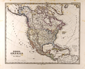
North America Map in German - Gotha Justus Perthes 1872 Atlas

North America Map in German - Gotha Justus Perthes 1872 Atlas

Map of North America in German from the Gotha Justus Perthes 1872 Atlas. Full title: Nord-America.

Page Size: 24.5 x 19.75 in (617 x 501 mm)

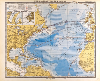
North Atlantic Ocean Map in German - Gotha Justus Perthes 1872 Atlas

North Atlantic Ocean Map in German - Gotha Justus Perthes 1872 Atlas

Map of the North Atlantic Ocean in German from the Gotha Justus Perthes 1872 Atlas. Full title: Nord-Atlantischer Ocean.

Page Size: 25.75 x 20.75 in (650 x 526 mm)

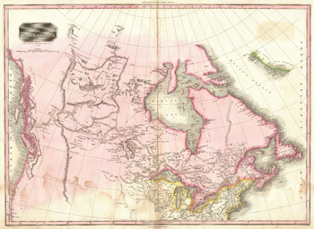
Pinkerton Map of British North America or Canada (1818)

Pinkerton Map of British North America or Canada (1818)

1818 map of British North America (Canada) by Scottish antiquarian and cartographer John Pinkerton (1758 - 1826). Full title: British Possessions in North America.

Page Size: 19 x 14 in (483 x 352 mm)

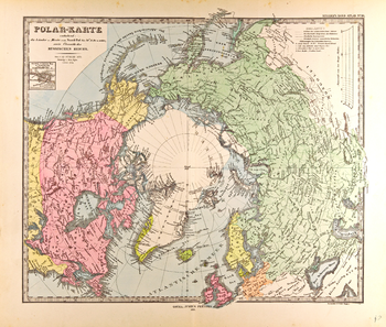
Polar Map in German - Gotha Justus Perthes 1872 Atlas

Polar Map in German - Gotha Justus Perthes 1872 Atlas

Map of centered on the North Pole in German from the Gotha Justus Perthes 1872 Atlas. Full title: Polar-Karte enthalend: die Länder u. Meere vom Nord-Pol bis 50° N. Br. u. weiter; sowie Übersicht des Russischen Reichs.

Page Size: 24.5 x 20.75 in (617 x 524 mm)

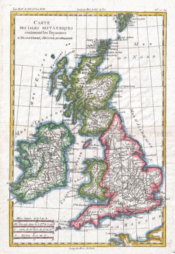
Raynal and Bonne Map of British Isles (1780)

Raynal and Bonne Map of British Isles (1780)

1780 map of the British Isles by Royal Cartographer to France Rigobert Bonne (1727 - 1794), one of the most important cartographers of the late 18th century. Full title: Carte des Iles Britanniques contenant les Royaumes d'Angleterre, d'Ecosee et d'Irelande.

Page Size: 9.5 x 13.75 in (239 x 347 mm)

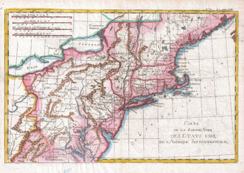
Raynal and Bonne Map of Northern United States (1780)

Raynal and Bonne Map of Northern United States (1780)

1780 map of the Northern United States by Rigobert Bonne (1727 - 1794), one of the most important cartographers of the late 18th century. Full title: Carte de al Partie Nord des Etats Unis de l'Amérique Septentrionale.

Page Size: 13.75 x 9.75 in (347 x 246 mm)

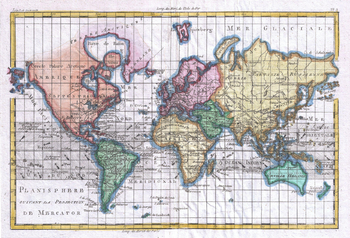
Raynal and Bonne Map of the World (1780)

Raynal and Bonne Map of the World (1780)

1780 map of the World by Rigobert Bonne (1727 - 1794), one of the most important cartographers of the late 18th century. Full title: Planisphere suivante la Projection de Mercator.

Page Size: 13.75 x 9.5 in (347 x 236 mm)

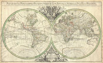
Sanson Map of the World on Hemisphere Projection (1691)

Sanson Map of the World on Hemisphere Projection (1691)

1691 hemisphere map of the World by French cartographer Nicolas Sanson. Full title: Mappe-monde: Geo-Hydrographique, ou Description Generale du Globe Terrestre et Aquatique en Deux-Plans-Hemipsheres, ou sont exactement remarquées en General Toutes les Parties de la Terre et de L'Eau, suivant les Relations les plus Nouvelles. Par le Sr. Sanson Geographe Ordinaire du Roy.

Page Size: 23 x 14 in (579 x 354 mm)

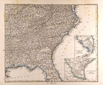
Southeastern United States Map in German (1872)

Southeastern United States Map in German (1872)

Map of the southeastern United States in German from the Gotha Justus Perthes 1872 Atlas. Full title: Petermann: Vereinigte Staaten von Nord-Amerika in 6 Blättern, Bl. 6.

Page Size: 25 x 20.75 in (635 x 524 mm)

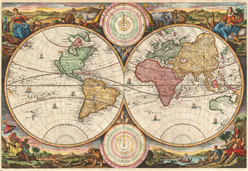
Stoopendaal Map of the World in two Hemispheres (1730)

Stoopendaal Map of the World in two Hemispheres (1730)

1730 hemisphere map of the World by Dutch illustrator and cartographer Daniel Stoopendaal for publication in the Keur Bible. Full title: Werelt Caert.

Page Size: 18 x 12.5 in (454 x 314 mm)

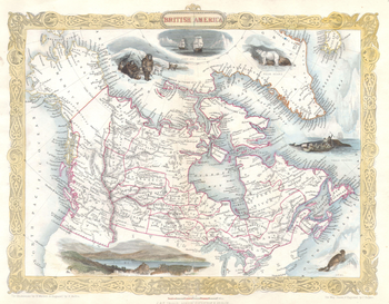
Tallis Map of Canada or British America with Oregon (1849)

Tallis Map of Canada or British America with Oregon (1849)

1849 map of British America and Russian America (Alaska) by John Tallis and Company. Map title: British America

Page Size: 18 x 14.25 in (457 x 356 mm)

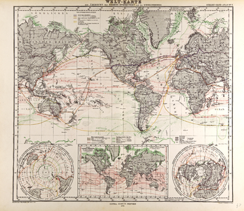
World Map - Gotha Justus Perthes 1872 Atlas

World Map - Gotha Justus Perthes 1872 Atlas

Map of the World in German from the Gotha Justus Perthes 1872 Atlas showing ocean currents, sea ice, and sea floor features such as reefs. Full title: Welt-Karte zur Übersicht der Meeres-Strömungen und des Schnellverkehrs.

Page Size: 24.25 x 21 in (612 x 527 mm)

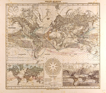
World Map in German - Gotha Justus Perthes 1872 Atlas

World Map in German - Gotha Justus Perthes 1872 Atlas

Map of the World in German from the Gotha Justus Perthes 1872 Atlas showing wind currents, shipping routes and land cover. Full title: Welt-Karte zur Überscht der Lut-Strömungen und der See-Wege.

Page Size: 23.75 x 20.75 in (602 x 526 mm)

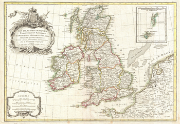
Zannoni Map of the British Isles: England, Scotland, Ireland (1771)

Zannoni Map of the British Isles: England, Scotland, Ireland (1771)

1771 map of England, Scotland and Ireland by French geographer and cartographer Jean Janvier for Jean Lattre's 1783 final issue of the Atlas Moderne. Full title: Les Iles Britanniques Comprenant les Royaumes d'Angleterre d'Ecosse et d'Irelande divisés en grandes provinces Dréssés sur les Observations Astronomiques par le Sr. Janvier Géographe

Page Size: 17 x 11.75 in (427 x 295 mm)
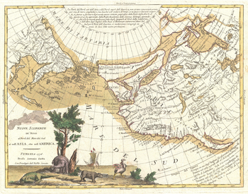
Zatta Map of California and the Western Parts of North America (1776)

Zatta Map of California and the Western Parts of North America (1776)

1766 map of the the new discoveries in the North Pacific by Italian cartographer Antonio Zatta. Full title: Nuove Scoperte de' Russi al Nord del Mare del sud sí nell' Asia, che nell'America.

Page Size: 18 x 14.25 in (454 x 357 mm)

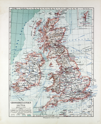
Map of Great Britain and Ireland in German (1899)

Map of Great Britain and Ireland in German (1899)

1899 map of Great Britain and Ireland in German showing sea depth and indications of relief on land by German publisher Bibliographisches Institut in Leipzig: Full title: Grossbritannien und Ireland.

Page Size: 20.5 x 25 in (518 x 635 mm)

bottom of page