top of page


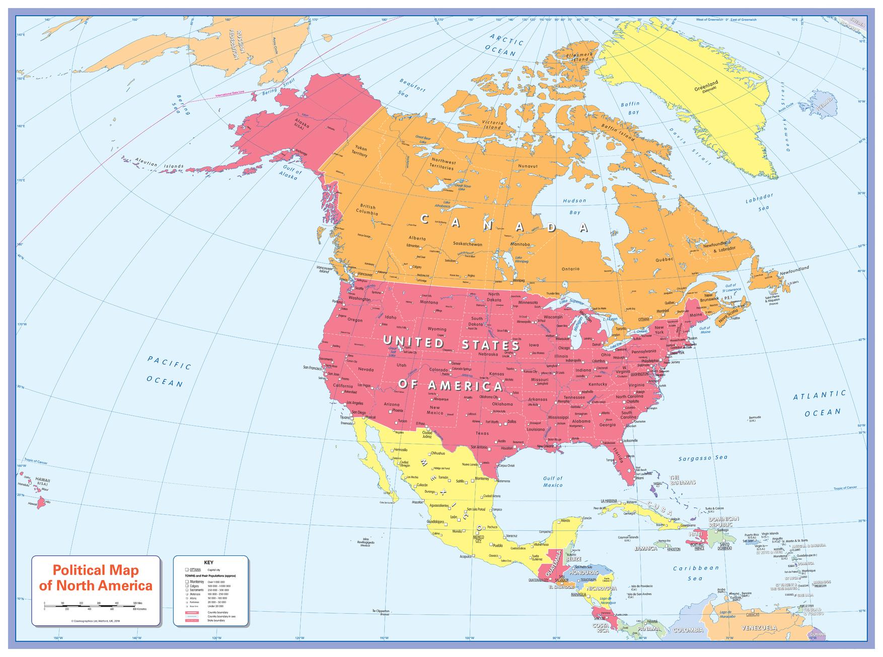
Colour blind friendly Political Wall Map of North America
Cosmographics
There is likely to be at least one child in every classroom that is colour blind. Designed especially to work with any form of colour blindness, this colourful, easy to read children's map of North America showing countries, states, capitals and a selection of cities and main towns is ideal for the classroom.
Page Size: 35.75 x 26.5 in (905 x 668 mm)
Buy this map on MapTrove.ca
bottom of page