top of page
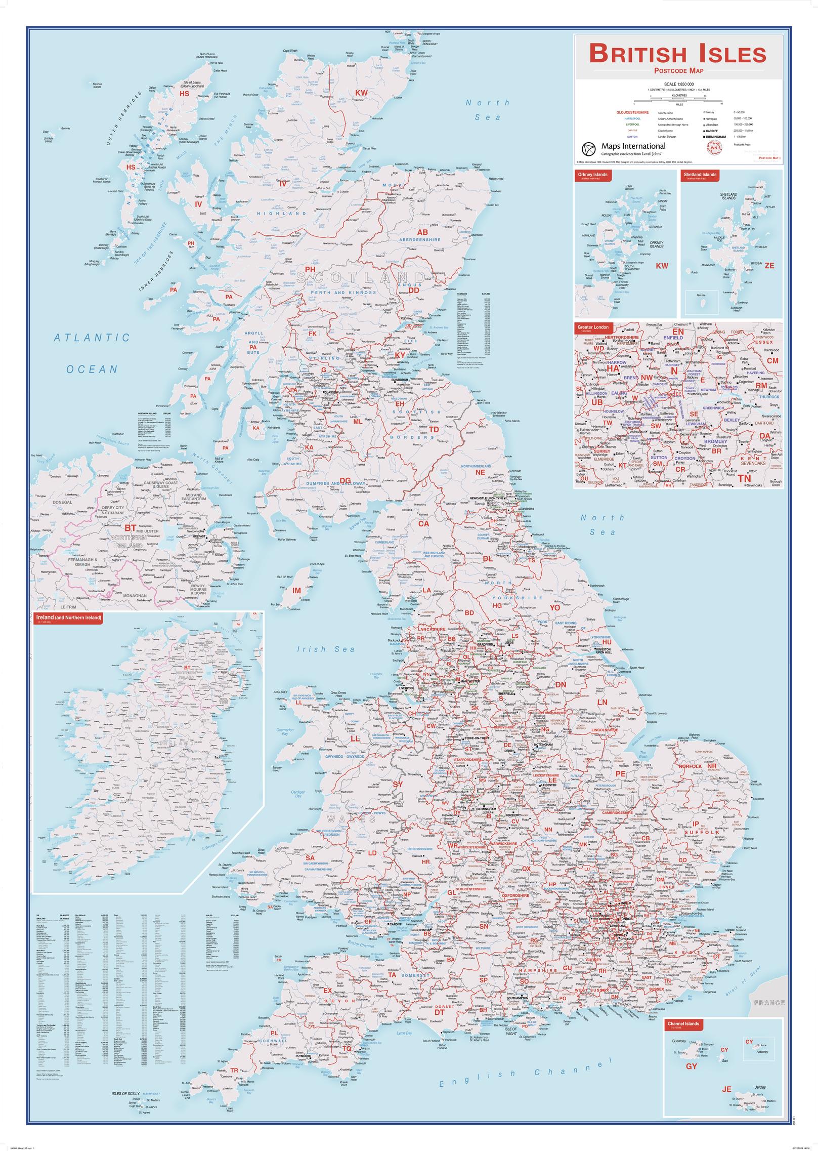
British Isles Postcode Map
Maps International
This British Isles Postcode map contains information including borough, county and district names. Cities are marked on showing the approximate population size. Postcode areas of the British Isles are clearly shown and the Greater London area is expanded to show these postcode areas clearly. British Isles postcodes are needed on a day-to-day basis and this map makes a great reference tool. This map shows each postcode area clearly - e.g. CV, NW, B. This British Isles postcode map is easy to display in offices or post rooms.
Page Size: 33.25 x 47 in (841 x 1189 mm)
Buy this map on MapTrove.ca or MapTrove.com

bottom of page