


Natural Resources Canada
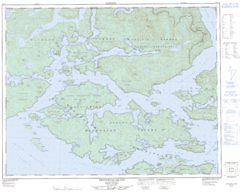
Broughton Island - 92 L/15 - British Columbia
Canadian topographic map of Broughton Island, British Columbia. NTS sheet 092L15 Edition 3.
Page Size: 32 x 25.5 in (809 x 642 mm)
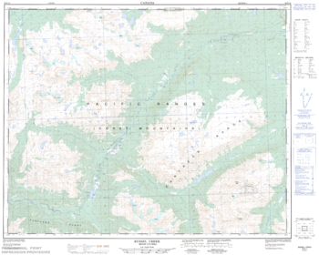
Bussel Creek - 92 N/14 - British Columbia
Canadian topographic map of Bussel Creek, British Columbia. NTS sheet 092N14 Edition 1.
Page Size: 31.25 x 25 in (792 x 634 mm)
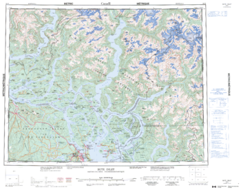
Bute Inlet - 92 K - British Columbia
Canadian topographic map of Bute Inlet, British Columbia. NTS sheet 092K Edition 3.
Page Size: 28 x 22 in (707 x 557 mm)
Buttle Lake - 92 F/12 - British Columbia
Canadian topographic map of Buttle Lake, British Columbia. NTS sheet 092F12 Edition 6.
Page Size: 40 x 28 in (1016 x 711 mm)
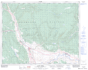
Cache Creek - 92 I/14 - British Columbia
Canadian topographic map of Cache Creek, British Columbia. NTS sheet 092I14 Edition 3.
Page Size: 32.25 x 25.5 in (814 x 647 mm)
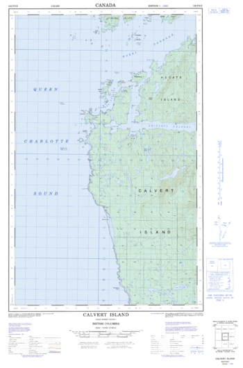
Calvert Island - 102 P/9 E - British Columbia
Canadian topographic map of Calvert Island, British Columbia. NTS sheet 102P09 E Edition 1.
Page Size: 18.5 x 28 in (466 x 706 mm)
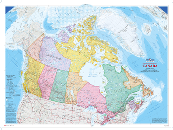
Canada Wall Map (2009) - Bilingual - Atlas of Canada
This bilingual colourful edition of the Canada map published in 2009 is the largest of the Atlas of Canada wall maps. Relief shading highlights the physiography of the country and the map's projection provides a three-dimensional view of Canada.
Page Size: 64.25 x 48.25 in (1626 x 1220 mm)
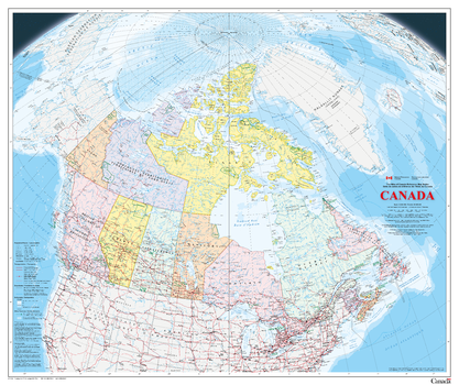
Canada Wall Map - Bilingual - Atlas of Canada
This bilingual map is the latest publication in the Atlas of Canada Reference Map Series. It is an update to the 1:6 000 000 paper map of Canada published in 2006. The map uses a vertical near-side perspective projection, which provides a unique three-dimensional view of Canada. Most data are current to the period 2010 to 2013.
Page Size: 42.5 x 35.75 in (1078 x 906 mm)
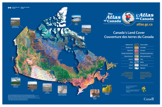
Canada's Land Cover / Couverture des terres du Canada
Contained within the Atlas of Canada Poster Map Series, is a poster showing the different types of land cover across the Country. The map is primarily based on AVHRR (Advanced Very High Resolution Radiometer) data, offering very precise detail. The land cover image contains 31 land cover classes. These have been grouped into 9 large land cover classes from coniferous forest to snow and ice. There are photos showing visually what each of these 9 land cover areas look like.
Page Size: 35.5 x 23.5 in (902 x 597 mm)
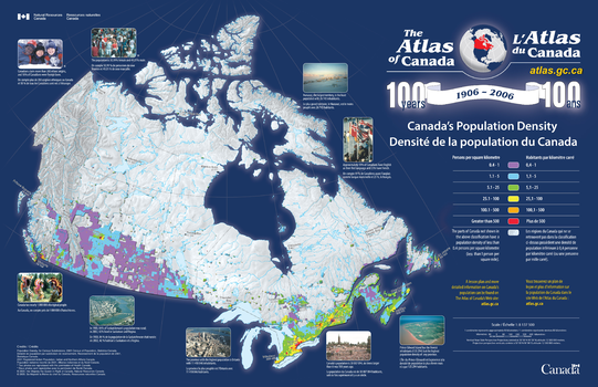
Canada's Population Density / Densité de la population du Canada
Contained within the Atlas of Canada Poster Map Series, is a poster showing population density across Canada. There is a relief base to the map on top of which is shown all populated areas of Canada where the population density is great than 0.4 persons per square kilometer. This area is then divided into five colour classes of population density based on Statistics Canada's census divisions.
Page Size: 34 x 22 in (864 x 559 mm)
Canim Lake - 92 P/15 - British Columbia
Canadian topographic map of Canim Lake, British Columbia. NTS sheet 092P15 Edition 2.
Page Size: 31.5 x 25.25 in (795 x 640 mm)
Cape Caution - 92 M/4 - British Columbia
Canadian topographic map of Cape Caution, British Columbia. NTS sheet 092M04 Edition 2.
Page Size: 31.75 x 25.25 in (804 x 639 mm)
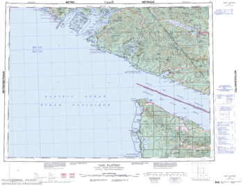
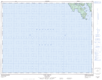
Cape Flattery - 92 C - British Columbia
Canadian topographic map of Cape Flattery, British Columbia. NTS sheet 092C Edition 4.
Page Size: 28.25 x 21.75 in (717 x 551 mm)
Cape Parkings - 102 I/8 - British Columbia
Canadian topographic map of Cape Parkings, British Columbia. NTS sheet 102I08 Edition 3.
Page Size: 32.25 x 25.25 in (815 x 641 mm)
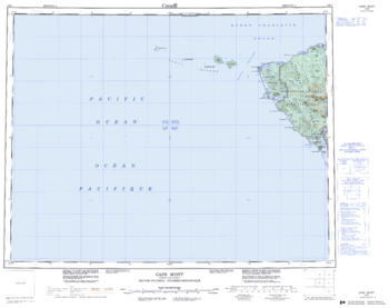
Cape Scott - 102 I - British Columbia
Canadian topographic map of Cape Scott, British Columbia. NTS sheet 102I Edition 2.
Page Size: 27.75 x 22 in (702 x 555 mm)
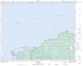
Cape Scott - 102 I/16 - British Columbia
Canadian topographic map of Cape Scott, British Columbia. NTS sheet 102I16 Edition 3.
Page Size: 31.75 x 25.5 in (806 x 642 mm)
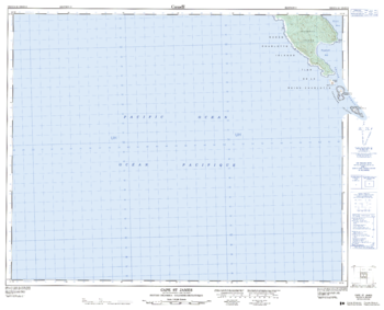
Cape St James - 102 O/14 - British Columbia
Canadian topographic map of Cape St James, British Columbia. NTS sheet 102O14 Edition 3.
Page Size: 31.75 x 25.75 in (803 x 650 mm)
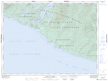
Carmanah Creek - 92 C/10 - British Columbia
Canadian topographic map of Carmanah Creek, British Columbia. NTS sheet 092C10 Edition 5.
Page Size: 33.75 x 25.5 in (852 x 641 mm)

Catto Creek - 92 M/8 - British Columbia
Canadian topographic map of Catto Creek, British Columbia. NTS sheet 092M08 Edition 2.
Page Size: 31.5 x 25 in (798 x 633 mm)
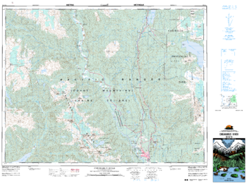
Cheakmus River - 92 G/14 - British Columbia
Canadian topographic map of Cheakmus River, British Columbia. NTS sheet 092G14 Edition 3.
Page Size: 35.5 x 26.5 in (897 x 669 mm)