top of page
Historic Hertfordshire County Map
XYZ Maps
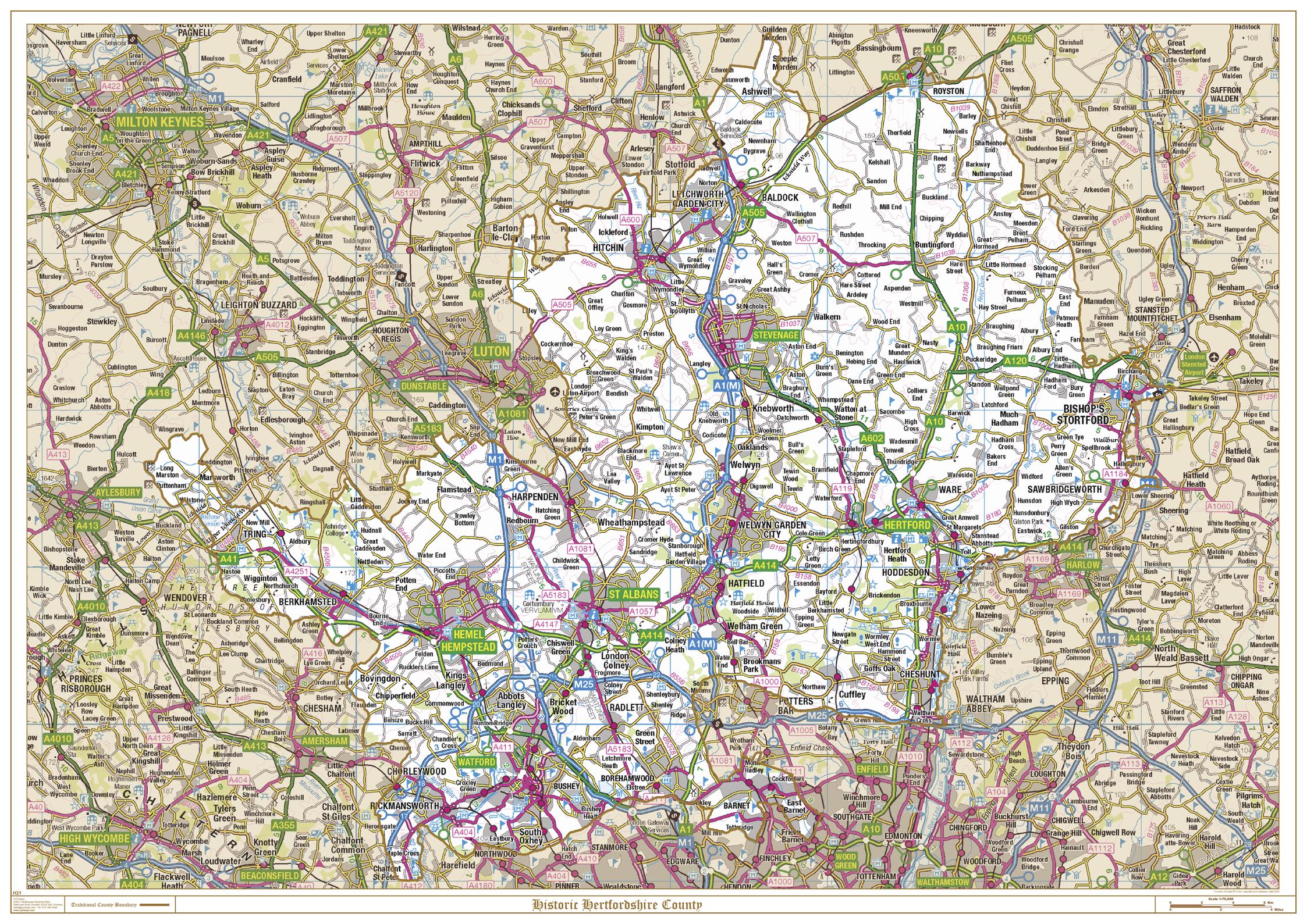
This is a historic county map of Hertfordshire, highlighting the traditional county border, the surrounding area is faded out with a sepia tint for excellent contrast. The historic map covers, Royston, Letchworth Garden City, Bishops Stortford, Welwyn Garden City, Borehamwood, Hatfield, Hemel Hempstead, Hitchin, Hertford, St Albans, Tring, Watford and Rickmansworth. The traditional county map has the historic county boundaries overlaid on an up to date Ordnance Survey 1:250,000 scale map.
Page Size: 47 x 33.25 in (1189 x 841 mm)
Buy this map on MapTrove.ca
bottom of page